
With steady growth over the last year, Nearmap is primed to build upon their success in Utah.

We’re all familiar with aerial imagery. Based on the fact that you’re reading this article on the internet, I’m also going to assume that you’ve looked at aerial photographs of things that are near and dear to your heart — a birds eye view of your house, the outline of your favorite golf course, a place in the mountains you envision escaping to during a particularly dreadful day of work. I can still remember the first time I looked down at my house through satellite images and was astounded by what I saw — HEY THAT’S ME!
Of course, aerial imagery serves much greater purposes than giving us an addictive reason to doink around on the internet. High-resolution aerial photos are cool by themselves, but they become even cooler when you start applying them in a business sense.
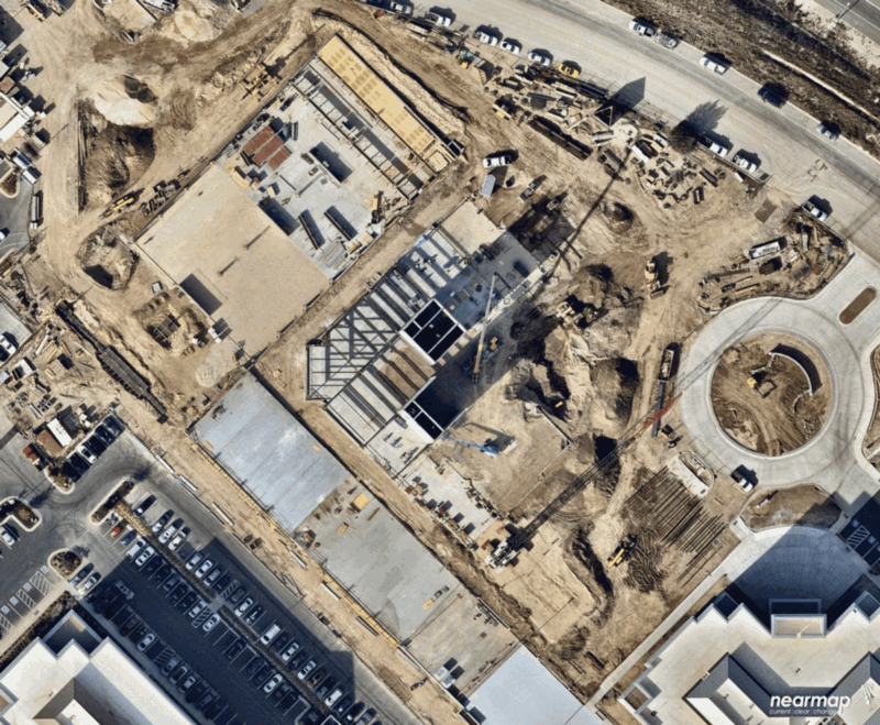
That’s where Nearmap enters the picture, providing “updated, instant-access, ultra-high resolution aerial PhotoMaps and easy-to-use library of historical images.” Let’s say I was wondering what the construction process looked like for the new MX building in Lehi. Well, wonder no more:
Nearmap started in Australia and has grown into a publicly-traded company on the Australian Stock Exchange. Nearly one year ago, they began expanding aggressively into the United States and settled on a very unique, specific location for their stateside headquarters: South Jordan, Utah.
“Utah was chosen for a lot of reasons,” said Tony Agresta, VP of Marketing. “One of the key reasons is the people and the background that they have in technology, cloud-based software, and innovation. There’s a huge talent pool that we can draw upon….Utah also provides a good business climate for us, it’s accessible, it has the right time zone difference so we’re not too far behind Australia, so we can interact with the offices in Sydney.”
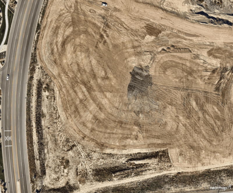
Nearmap has experienced such success/growth in America that they recently completed a capital raise of $15 million, with one of the main areas of focus being expansion inside Utah. This means more jobs being created in Utah and it also means we can look at more cool images of structures being built, like this one of the Overstock building in SLC:
Nearmap’s current camera system delivers quick, location-based content. Mounted in the bottom of an airplane, the patented system swivels as the plane flies to keep everything level and flat. This is obviously relevant for measuring purposes, where everything must be set exactly to scale.
The plane then flies back and forth, capturing content that is streamed into the cloud. Photos are updated multiple times per year and images are available within days of their capture.
As part of the funding raise, Nearmap is prepared to debut a new method for capturing imagery in the United States: HyperCamera2.
“HyperCamera2 allows you to not only take pictures straight down, which are called orthophotos, it allows you to take oblique images,” said Agresta. “Oblique images are at a 45-degree angle, they give you the height of the building and give you a lot more dimensionality around the geography. The interesting thing about HyperCamera2 is that it takes both of those types of photos, it takes orthophotos and oblique photos. This is a key thing because now you can not only see directly down, but you can see at a 45-degree angle that gives you depth and 3D.”
By combining both types of photos, Nearmap can now serve a variety of customer needs, providing maps that are set to scale alongside a more 3-dimensional view of the landscape, allowing users to measure the height of buildings, calculate square footage on individual floors, or anything of that nature.
Used by a variety of industries, Nearmap’s imagery allows customers to measure and diagram without ever leaving their office, a stark contrast to the old days of going out into the field and measuring/working.
“People have found innovative ways to reinvent their work processes, said Agresta. “If you’re a solar company and you’re interested in putting in solar panels, you can look at all the houses that currently have them and you can target your sales force to neighboring houses without having to go and drive the neighborhood. Then you can go and build proposals that have high-quality imagery inside the proposal. If you’re a landscaper, roofer, or architect, you can measure distances very easily and do the same kinds of things. If you are a city or county government and you’re experiencing high growth, you can plan more efficiently and you can report on progress you’ve made with the imagery. It transforms the way people work.”


